
It all began with a one-sided friendly competitive thought – if Augusta could do it, so could Atlanta.
This immediately came to mind after reading an article in Georgia Library Quarterly written in 2009 by Dottie Demarest, then the genealogy and local history librarian at the East Central Georgia Regional System (now the Augusta-Richmond County Public Library), about the Eula M. Ramsey Johnson Memorial Funeral Program Collection.
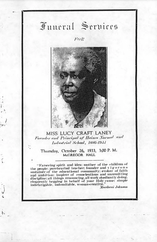
In the article, Ms. Demarest spoke about how a single donation from Gloria Ramsey Lucas, the niece of Eula Johnson, of nearly 200 programs in 2005 became the beginning of the Library’s African American Funeral Program Collection. The collection has since grown to more than 1500 programs dating back to the 1930s. After reading the article, I was excited that such a collection existed and had been digitized and made available through the Digital Library of Georgia (DLG). I was also inspired, knowing that we, the royal we, could create a similar collection in Atlanta.
It was then that the African American Funeral Program Project, as I call it, was born.
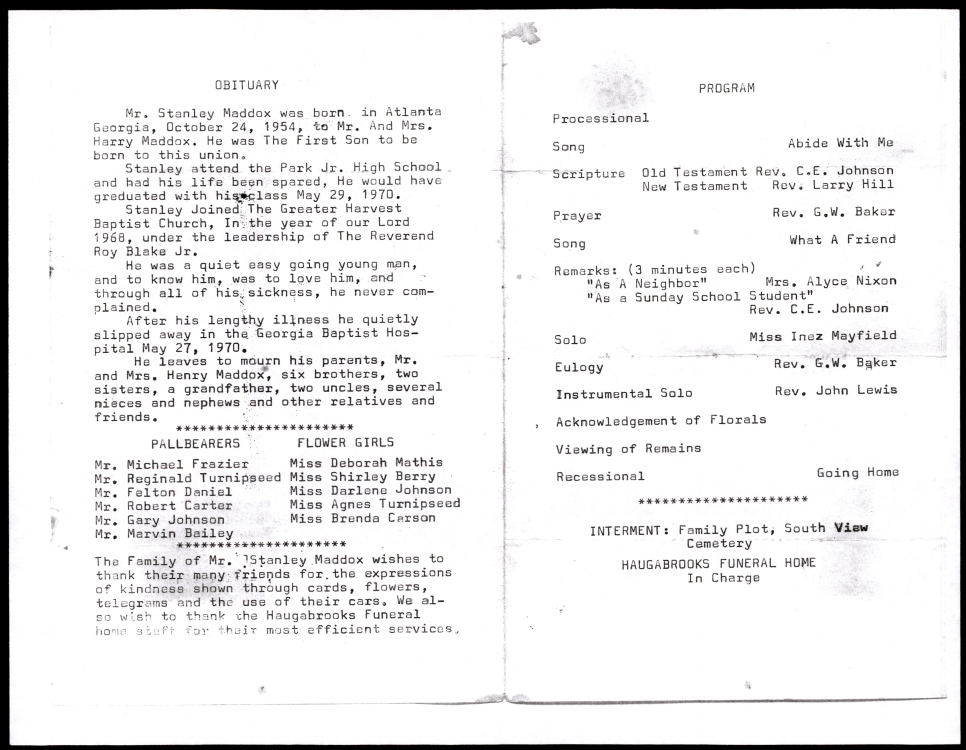
The goals for the project were to collect African American funeral programs and donate them to the Auburn Avenue Research Library on African American Culture and History where they would be preserved, and people would have access to them for many years to come. The goal for the programs was to have them digitized and added to DLG and in May 2020, that dream became a reality. Now, several thousand funeral programs collected and housed at the Auburn Avenue Research Library are available for everyone to see. What started as a friendly competitive thought has now become another resource for researchers as well as scholars (I am one of the latter) who are interested in the individuals and local communities represented in the individual documents. The Atlanta funeral programs collection could possibly provide the information needed by a family historian (like myself) working to piece together their family’s story. This collection will always mean a lot to me, not only because I helped to start it but also because members of my own family are featured in the collection. My uncle Stanley Maddox, whom I never got a chance to meet, passed away as a child. A press release for the collection happened a day after the 50th anniversary of his death and I thought what a fitting way to commemorate that day.
The work continues, as there are more programs to process and to collect.
I hope that others will be inspired by this collection and create one in their own area.
If you cannot start a collection, check your local area or your ancestral research area to see if a collection already exists and contact them to see if they are taking donations.
As for digitized collections, in additional to the Atlanta collection, there are a few more African American funeral program collections in Georgia, including the Willow Hill Heritage and Renaissance Center Digital Archive collection at Georgia Southern University, the African American funeral programs from the Augusta-Richmond County Public Library System and Funeral programs from the Thomas County Public Library System collections, both of which are available through DLG.
–Tamika Strong
Reference Archivist, Georgia Archives
Wesley Chapel Genealogy and Historical Research Group