New online records are now available for people researching their families in Albany, Georgia. The Digital Library of Georgia has just added a collection of city directories housed at the Dougherty County Public Library, dating from 1922-1950. The collection, Albany, Georgia City Directories, is available at dlg.usg.edu/collection/zgn_albcd and contains eleven directories covering Albany during intermittent years from 1922 to 1950, and one 1937 directory from Americus.
City directories existed before telephone directories and often listed the names, addresses, occupations, and ethnicities of people in American towns and cities. Because they contain so much detailed information, they are vital resources for researchers, genealogists, and the general public. According to the Library of Congress, city directories “are among the most important sources of information about urban areas and their inhabitants. They provide personal and professional information about a city’s residents as well as information about its business, civic, social, religious, charitable, and literary institutions.”
Christina Shepherd, head of reference for the Dougherty County Public Library describes the relevance of Albany’s city directories to the researchers in her library:
“Several patrons have asked to use the directories to see who lived in their house, to trace an ancestor’s life, verifying use of land or to see who ran what businesses. A specific example is in 1940 there was a tornado that came through and destroyed a lot of downtown Albany. While these directories do not show that event, they show the city stayed strong after that event. The directories have the addresses where businesses were before the tornado in 1939 to where they had to relocate in 1941. Just think, those directories were the same books that our relatives, our city leaders, and others used to find an address or phone number!”
J. Douglas Porter, a writer based in Albany Georgia notes: “Much of the material I have been looking at has been digitized and is searchable. This has not only been a useful time-saver, but it has also proven to be more reliable than my visual scans of many pages of materials. The city directories have a high level of historic value and potential for reuse by multiple audiences well into the future. In fact, they will become even more valuable as time passes and the paper copies crumble.”
Link to featured images:
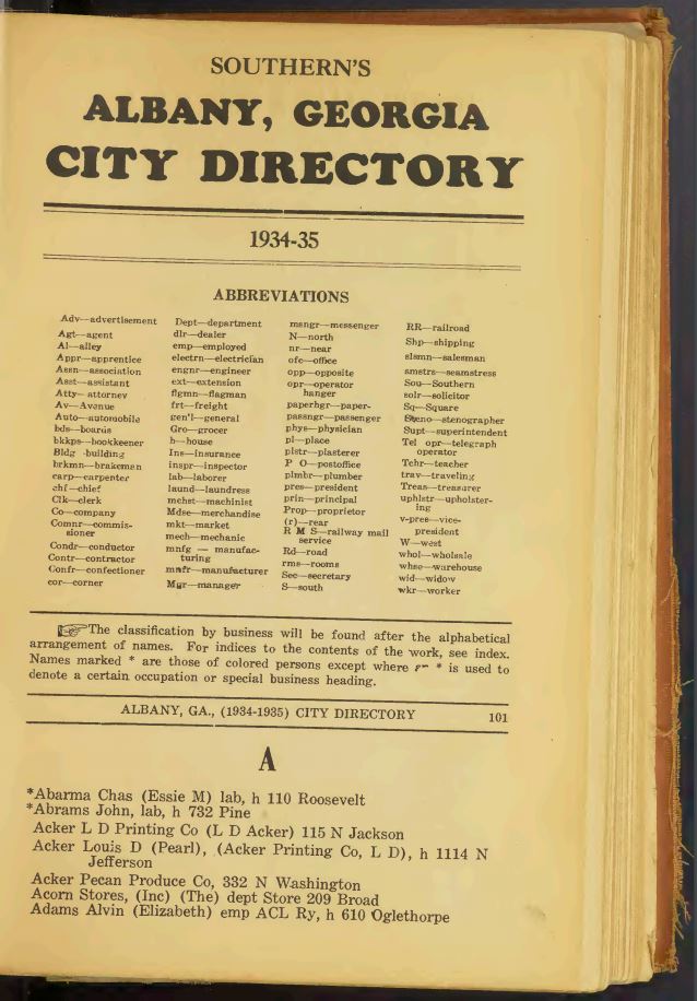
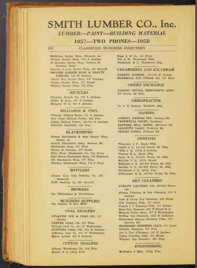
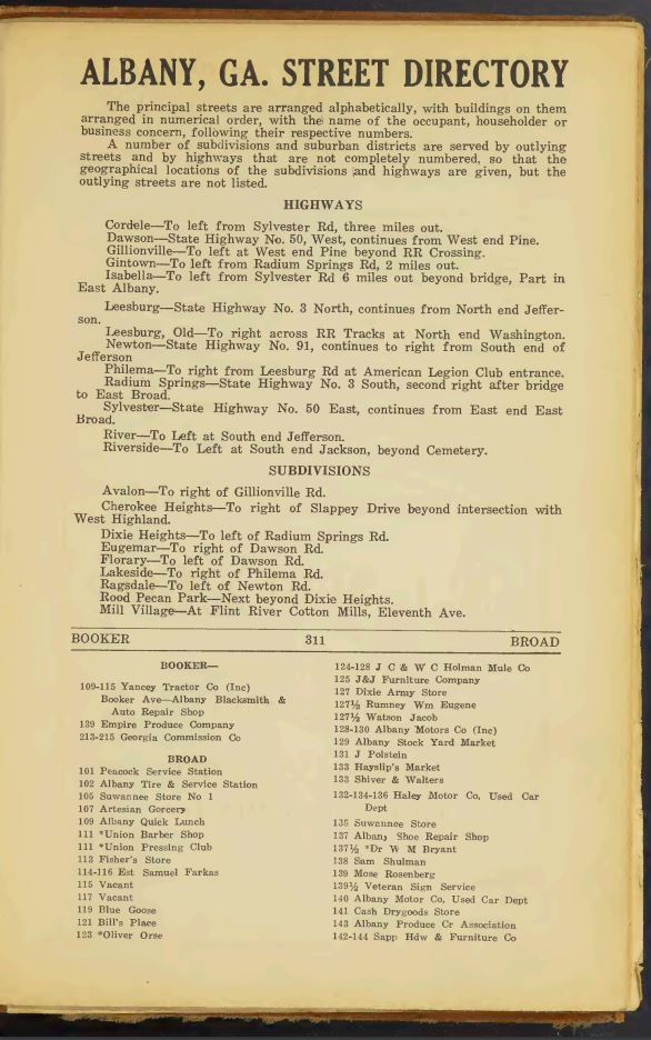
Albany, Georgia city directory 1934-35 containing an alphabetically arranged list of names, a classified business directory, a street directory, and much useful miscellaneous information
dlg.galileo.usg.edu/do:zgn_albcd_dir-albany1934-35
1934-1935 city directory for Albany, Georgia containing information that identifies Albany residents, their occupations and local businesses.
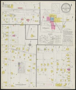
Albany, Georgia city directory 1934-35 containing an alphabetically arranged list of names, a classified business directory, a street directory, and much useful miscellaneous information, page 12
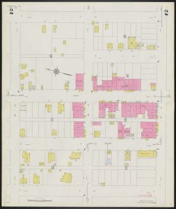
Albany, Georgia city directory 1934-35 containing an alphabetically arranged list of names, a classified business directory, a street directory, and much useful miscellaneous information, page 213
Albany, Georgia city directory 1934-35 containing an alphabetically arranged list of names, a classified business directory, a street directory, and much useful miscellaneous information, page 222
About Dougherty County Public Library
The Dougherty County Public Library’s mission is “To Strengthen our Community by Inspiring, Encouraging, and Supporting Life-long Learning for all.” The goals of the library are to select, assemble and administer organized collections of educational and recreational library materials; to serve the community as a center of reliable information and a place where inquiring minds may encounter original, unorthodox, or critical ideas in our society; to provide opportunities and encouragement for individuals to continue their educations; to supplement and help formal education programs; to seek, continually, to identify community needs; to support civic groups, cultural activities, or cooperate with other agencies as they work for community good; to maintain and disseminate public information encouraging to individuals to better use the libraries as well as to contribute to the field of professional librarianship; to enhance interest and research in local history; and to provide opportunity for substantive recreational and constructive use of leisure time through the use of literature, music, films, and other forms. Visit docolib.org/
About the Digital Library of Georgia
Based at the University of Georgia Libraries, the Digital Library of Georgia is a GALILEO initiative that collaborates with Georgia’s libraries, archives, museums and other institutions of education and culture to provide access to key information resources on Georgia history, culture, and life. This primary mission is accomplished through the ongoing development, maintenance, and preservation of digital collections and online digital library resources. DLG also serves as Georgia’s service hub for the Digital Public Library of America and as the home of the Georgia Newspaper Project, the state’s historic newspaper microfilming project. Visit the DLG at dlg.usg.edu.