
DeKalb History Center’s bound plat map books from 1912-1936 represent a time when metropolitan/suburban DeKalb County was once rural farmland.
Funded by the Digital Library of Georgia’s competitive digitization subgrant program, a historic collection of plat map books ranging from 1912 to 1936 represent a time in the county’s history when metropolitan/suburban DeKalb County was once rural and composed mainly of farmland.
You can view the collection here: https://dlg.usg.edu/collection/dhc_dcpm
The collection contains ten DeKalb County plat map books created by the DeKalb County government for showing boundaries of properties for tax purposes. These books contain various cadastral maps of subdivisions, streets, and names of property owners throughout DeKalb County. Cadastral maps have been used to record property boundaries and land ownership for hundreds of years.
The natural degradation of these maps due to vigorous communal use accelerated the urgency of digitizing these maps for DeKalb County residents eager to research earlier incarnations of their city, neighborhoods, and personal property.
“Just during my own lifetime, I have seen my county grow from a region dominated by dairy farms to the thriving urban communities that it comprises today, ” said Claudia Stucke, a lifelong DeKalb County resident. “These plat books are integral to the center’s mission to preserve and make history accessible to the public, and we patrons use them frequently; but this handling, combined with the natural degradation of glue, binding, and paper, is taking its toll on this irreplaceable and important resource.”
Now that these digitized resources are available freely to the public, DeKalb County residents and other Georgia researchers can also access property information in the context of the larger metropolitan Atlanta area with a visual representation of the historical arc that began with the county’s agrarian roots in the early 1900, shaped by two World Wars, and by the mid-20th-century gave way to the factories, businesses, schools, and residential subdivisions that have made DeKalb County Georgia’s fourth-most populous county.
About the the DeKalb History Center (Decatur, Ga.)
The DeKalb History Center collects, preserves, and shares the wide-ranging stories of the people and places of DeKalb County. The DeKalb History Center envisions a county connected, enriched, and energized by people who see themselves in the histories we share and who engage with the stories of all the people and places that surround them. DHC is a membership based non-profit that relies on contributions from individuals, corporations and foundations who support their mission.
Learn more at https://dekalbhistory.org/
Selected images:
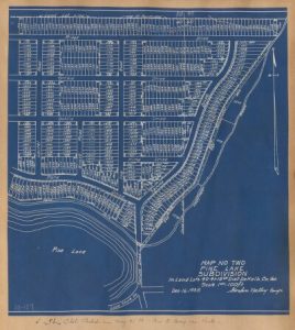
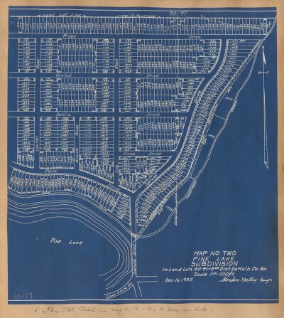
Book 10, Page 157
Date:
December 16, 1935
Description:
Land Lot(s): 40,41. District: 18. Street(s): Pine Lake, Ridge Drive, Dahlia Drive, King Drive, Spruce Drive. Notes: map no two Pine Lake subdivision, Dec 16, 1935.
https://dlg.usg.edu/record/dhc_dcpm_pb010-157
Courtesy of DeKalb History Center (Decatur, Ga.)
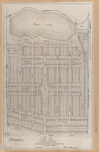
Description:
“Book 10, Page 122 Land Lot(s): 4. District: 18. Street(s): Rock Bridge Road, Club House Drive, Lake Shore Drive. Notes: Map of Pine Lake subdivision, May, 1935,” 1935-05. https://dlg.usg.edu/record/dhc_dcpm_pb010-122 Courtesy of the DeKalb History Center (Decatur, Ga.)
